
The best time to visit Kauai is May to early July or September to mid October, when the north shore is calm, the rain eases and the island is between its two crowd peaks. Lihue averages 85 °F (29.4 °C) in summer and the sea off Poipu reaches 81 °F (27.4 °C) in September. Plan around December to March, the wet months, when the north shore takes 8.3 inches (210 mm) of rain in March alone and big swell closes its beaches. One caveat for this winter: Hurricane Lowell crossed the island on September 7 and 8, 2026. Start with our Kauai hotel guide.
Kauai at a glance
- Best overall: May, June and September, the three months that combine dry weather, a calm north shore and lower visitor numbers.
- Warmest: July to September, average high 85 °F (29.4 °C) at Lihue and 88 °F (31.1 °C) on the dry west side.
- Coolest: February, average high 78 °F (25.6 °C), with nights at 66 °F (18.9 °C).
- Wettest: March, 5.6 in (142 mm) at Lihue and 8.3 in (210 mm) at Princeville on the north shore.
- Driest place: Barking Sands on the west coast, 17.8 in (452 mm) a year, against 75.2 in (1,910 mm) at Princeville, 25 miles away.
- Sea temperature: 76 °F (24.4 °C) in March, 81 °F (27.4 °C) in September, off the south shore.
- Busiest and quietest: 143,289 visitors in July 2025, 102,105 in September 2025, according to Hawaii's tourism statistics.
Kauai after Hurricane Lowell
Hurricane Lowell passed over Kauai and Niihau on the night of September 7 to 8, 2026, the first hurricane to hit Kauai directly since Iniki in 1992. Gusts above 80 mph were measured at six locations on the island, including 92 mph at Puu Lua and 84 mph at Lihue, and the National Weather Service forecast 6 to 10 inches of additional rain.
As of the Hawaii Tourism Authority update of September 15, 2026, the island is open but recovering unevenly. Lihue Airport is operating, power has been restored across most of the island, and south shore properties are taking arrivals again, while north shore properties have been slower to reopen. The authority's guidance is to contact your accommodation directly to confirm conditions and amenities, to check with activity providers before booking, and to adjust plans where appropriate. If you are travelling this autumn or winter, verify with the property rather than with a booking site.
Understanding the Kauai climate
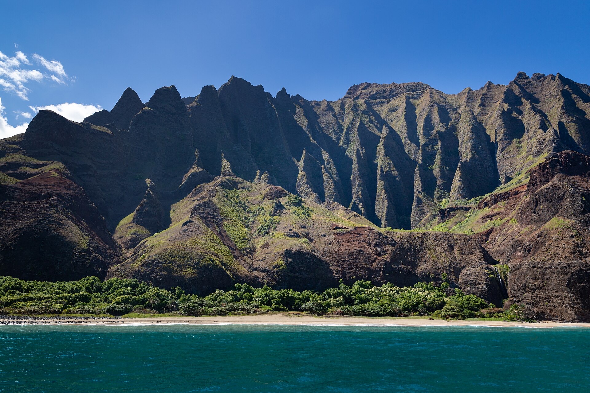
The Na Pali Coast, the eroded north west edge of the island. Photo : dronepicr, Wikimedia Commons, CC BY 2.0.

Kauai is the oldest of the main Hawaiian islands, and the most eroded, which is why its interior is a single high massif cut by canyons and why the coast has those fluted cliffs. That shape produces the sharpest rainfall gradient of any island in the chain. Rain falls where the trade winds are forced up, and almost nowhere else.
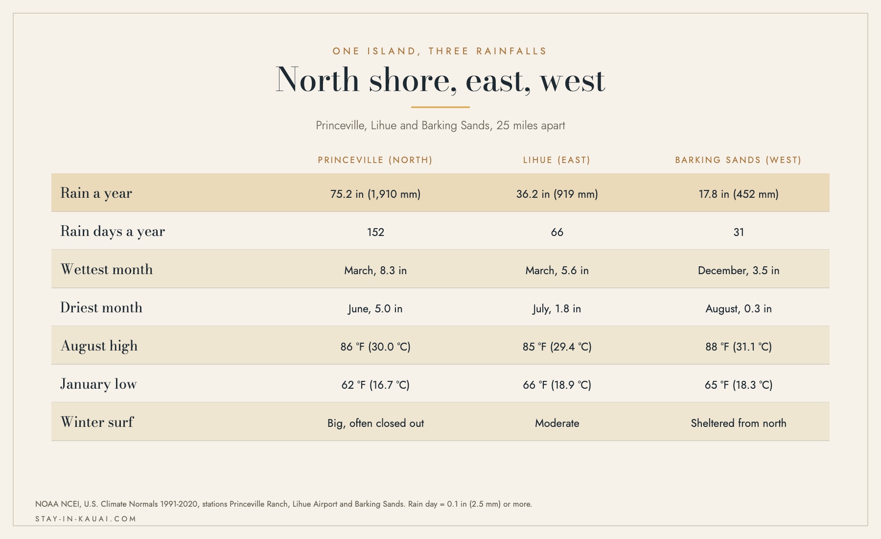
Three stations, 25 miles apart, four times the rain. Source: NOAA NCEI 1991-2020 normals.
Three NOAA stations tell the whole story. Princeville on the north shore averages 75.2 inches (1,910 mm) a year over 152 rain days. Lihue on the east coast averages 36.2 inches (919 mm) over 66 days. Barking Sands on the west coast averages 17.8 inches (452 mm) over 31 days. They are all on the same island, within 25 miles of one another.
The north shore: Hanalei and Princeville
The green that people come for is paid for in rain. March brings 8.3 in (210 mm) to Princeville, and even June, the driest month there, brings 5.0 in (127 mm). The north shore also has the fewest rain free stretches: 152 days a year record 0.1 inch or more, against 66 at Lihue.
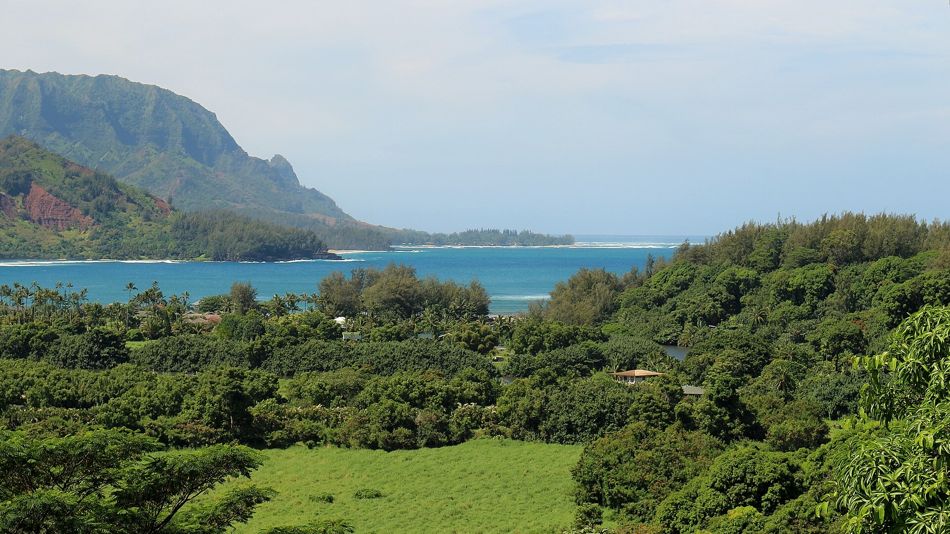
Hanalei Bay from the Princeville side in March. Photo : Bob Linsdell, Wikimedia Commons, CC BY 3.0.

In exchange, summer on the north shore is the best version of Kauai: Hanalei Bay flat enough for a paddle board, Kee and Tunnels open for snorkelling, and the Napali cliffs at their most reliable for boats. Our guide to the quiet north shore villages covers what sits beyond the bay.
The south and west: Poipu, Waimea and the Mana plain
Poipu sits in the rain shadow, which is why the large resorts are there. The nearest station with a full record, Lihue, takes 36.2 inches a year, and the west coast is drier still. The south shore is also warmer: 88 °F (31.1 °C) on the west side in August against 86 °F (30.0 °C) at Princeville.
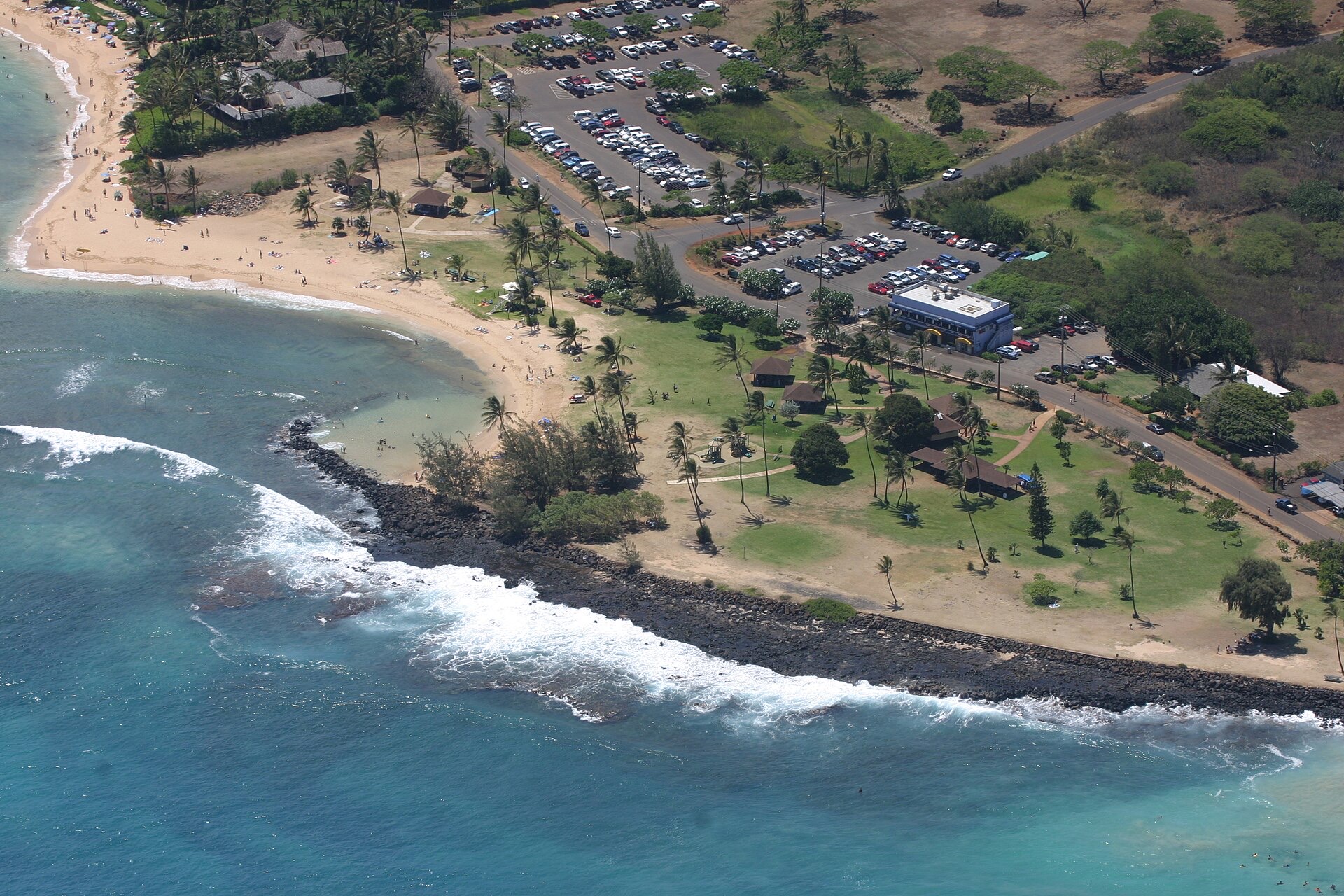
Poipu Beach Park on the dry south shore. Photo : Polihale, Wikimedia Commons, CC BY-SA 3.0.

The practical rule that locals use, and that our guide on reading the island's microclimates sets out in detail: if it is raining where you are, drive. Lihue to Poipu is 30 minutes, Poipu to Waimea another 30, and the weather is usually different at the end of it.
Why the yearly averages mislead
Kauai does not have a dry season in the way the Caribbean does. Lihue records between 4.4 and 6.9 rain days in every single month of the year. What changes is the volume: 5.6 in (142 mm) in March against 1.8 in (44 mm) in July. Rain here is normal, brief and often localised, and a forecast of scattered showers means a beach day with two interruptions, not a washout.
The drier months: April to October

Waimea Canyon, cut into the dry west of the island. Illustration: Stay In Kauai. Illustration : Luxury and Premium Hotel Booking in Kauai.
From April, rainfall at Lihue drops under 2.5 inches (64 mm) a month and stays there until October. Highs climb from 80 °F (26.7 °C) in April to 85 °F (29.4 °C) from July to September, and the sea warms from 77 °F (25.1 °C) to 81 °F (27.4 °C). The trade winds are at their steadiest, which keeps the humidity bearable and the north shore calm.
These are the months to plan around if you want the whole island open to you:
- The north shore beaches are swimmable, which they are not from October to April.
- Napali boat trips run at their highest reliability. See our guide to the Napali coast by catamaran.
- The Kalalau Trail is at its least slippery, although it is never easy.
- South shore surf arrives from May to September, covered in our guide to south shore summer swells.
The trade off is people. July 2025 brought 143,289 visitors to Kauai, the highest month of that year, and the July to August rush is covered in our guide to peak season on Kauai. May, June and September are the same weather with a third fewer people.
The wetter months: November to March
Lihue takes 4.0 in (102 mm) in November, 4.6 in (118 mm) in December and 5.6 in (142 mm) in March, spread over 6 to 7 rain days a month. Temperatures barely move: 78 to 81 °F (26 to 27 °C) in the afternoon, 66 to 69 °F (19 to 21 °C) at night. Nothing about winter here is cold.
What winter changes is the ocean and the north shore. Big north swells close beaches that are safe all summer, the road past Hanalei floods in heavy rain, and boats cancel. It is also when the island is greenest, when the waterfalls run hardest, and when the whales arrive. Our article on planning a stay in the rainy season makes the case for going anyway.
Precautions for a winter stay:
- Base on the south shore, where the rain and the swell are both lower.
- Do not plan a north shore beach day without checking the surf forecast that morning.
- Allow for flash flooding on the Hanalei side; the highway has one bridge and it closes.
- Book the Napali boat trip early in the stay, so a cancellation can be rescheduled.
Whale season: November to May
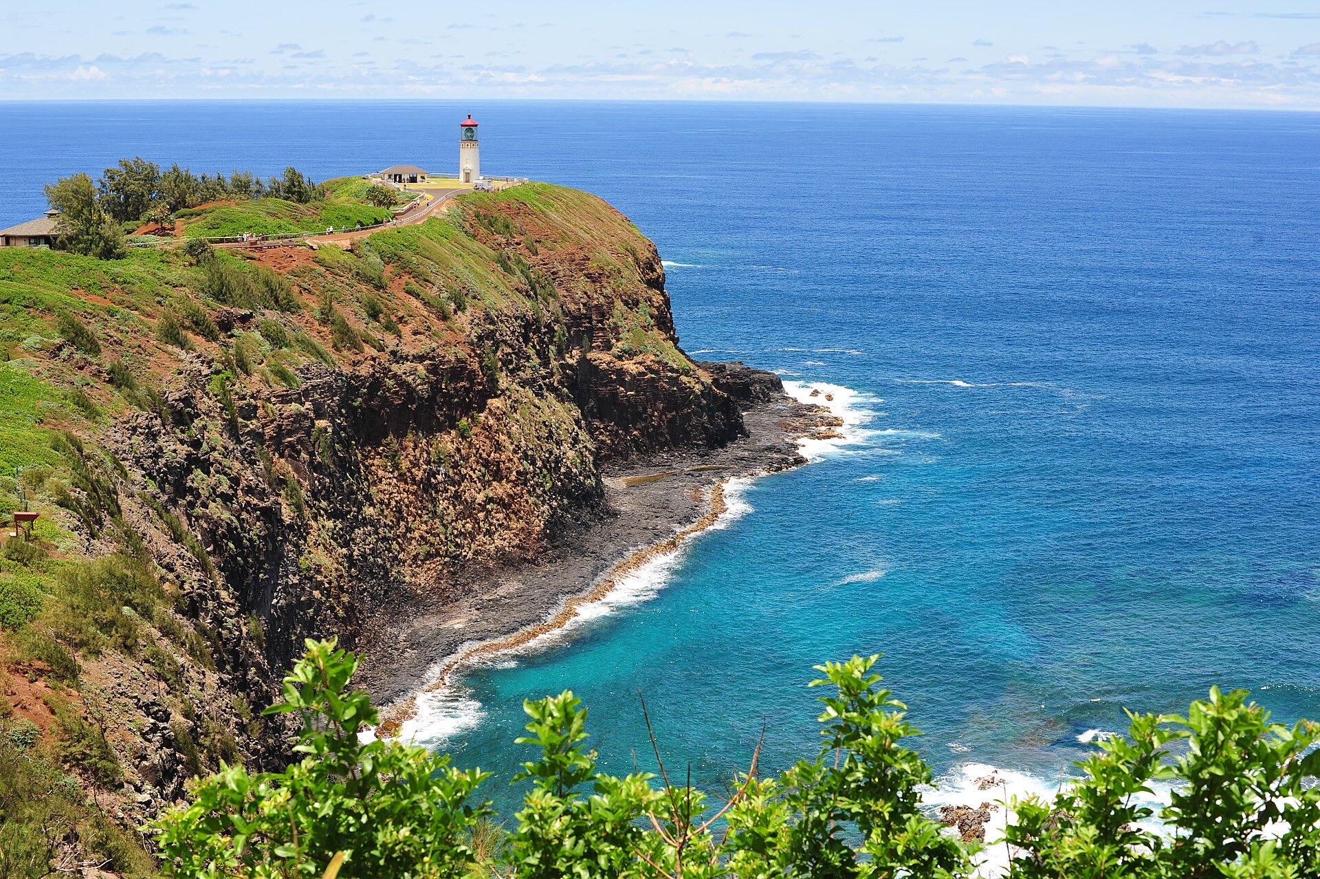
Kilauea Point on the north shore, one of the island's best land based whale lookouts. Photo : Chris Hunkeler, Wikimedia Commons, CC BY-SA 2.0.

Up to 12,000 humpback whales, more than half the North Pacific population, come to Hawaiian waters between November and May to breed and calve, according to the Hawaiian Islands Humpback Whale National Marine Sanctuary. They are generally seen from November to April, and the peak is January through March.
Kauai watches them from land more easily than most islands. Kilauea Point National Wildlife Refuge on the north shore, the cliffs at Makahuena Point on the south and the bluff at Kapaa all work with nothing but patience. Boats run out of Port Allen and Kikiaola on the sunnier west side, where winter seas are calmer than on the north shore.
Swell season: which beach, which month
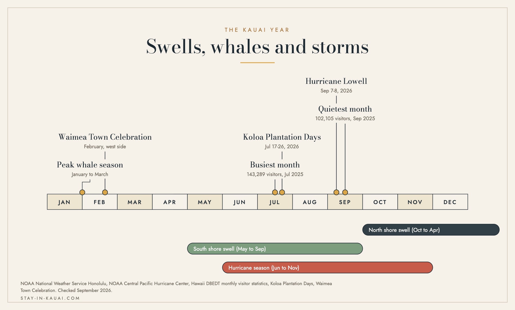
Swells, whales and storms across the Kauai year. Sources: NOAA National Weather Service, NOAA Central Pacific Hurricane Center, Hawaii DBEDT.
The single most useful thing to understand about Kauai is that its beaches change side with the season. North Pacific storms send swell to north and west facing shores from October to April. South Pacific storms send smaller swell, at most 10 to 15 feet according to the National Weather Service, to south shores from May to September.
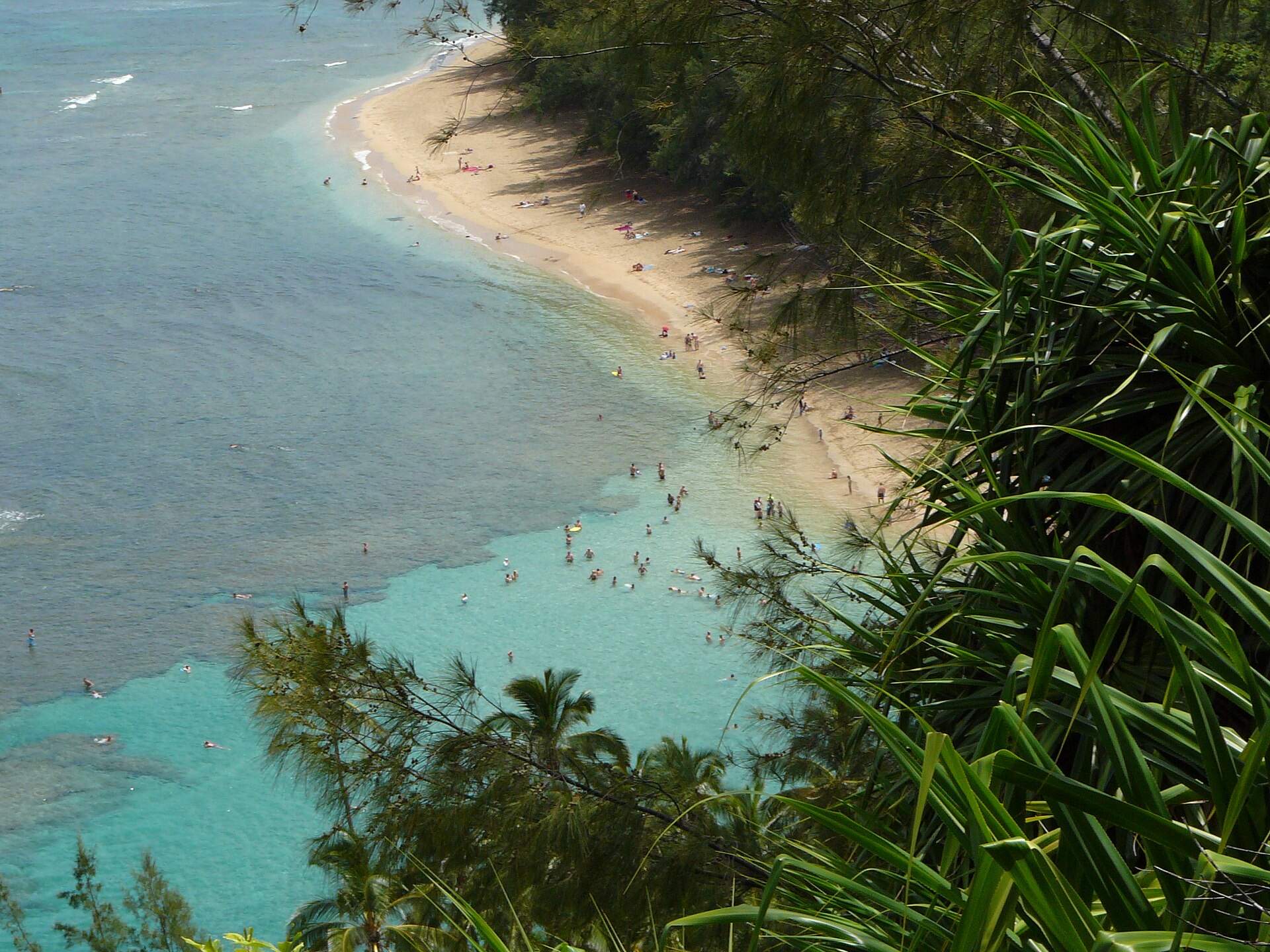
Kee Beach at the end of the north shore road, calm only in summer. Photo : MattWright, Wikimedia Commons, CC BY 2.0.

In practice:
- Kee, Tunnels, Hanalei and Anini: snorkelling and swimming from roughly May to September. In winter they range from rough to lethal.
- Poipu, Lawai and Salt Pond: reliable most of the year, with summer south swell adding surf at Poipu and Kalapaki.
- Polihale and the west: spectacular and almost never safe to swim, whatever the month.
- Lifeguards: swim at guarded beaches. Conditions change between one bay and the next, and a beach that was calm yesterday can be closed out today.
The same seasonality decides access to Haena. Haena State Park and the Kalalau Trail now require an advance entry reservation, which opens 30 days ahead through the state parks system, and a separate permit for anyone hiking past Hanakapiai. Our article on the new park fees and visitor caps explains what has changed.
Hurricane season: June to November
The central Pacific hurricane season runs from June 1 to November 30. Direct hits on Kauai are rare: before Lowell in September 2026, the last was Iniki on September 11, 1992. Two storms in 34 years is not a reason to avoid the island, but it is a reason to treat September and October bookings differently from April ones.
The practical points are the same as anywhere in the tropics, with one local twist: Kauai has a single ring road with no bypass, so a closure on one side means a long detour or none at all.
- Book refundable rates or insurance that names tropical cyclones from August onward.
- Follow the Central Pacific Hurricane Center rather than an app forecast once you are inside five days.
- Expect high surf and brown water advisories for days after a storm passes, even a distant one.
- Remember that recovery takes longer on an island: utilities and roads on the north shore took weeks after Lowell.
Kauai month by month
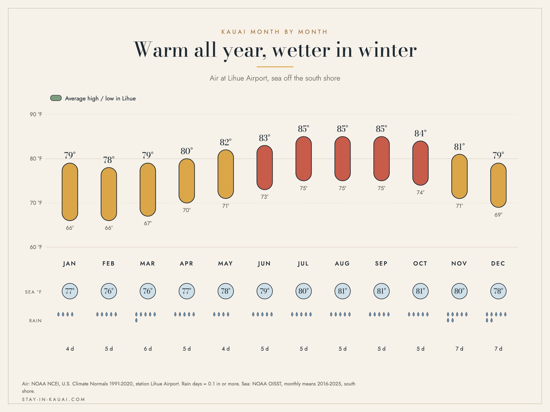
Kauai month by month at Lihue. Sources: NOAA NCEI 1991-2020 normals and NOAA OISST 2016-2025.
| Month | Avg high | Avg low | Sea | Rain, Lihue | Rain, north shore | Verdict |
|---|---|---|---|---|---|---|
| January | 79 °F (26.1 °C) | 66 °F (18.9 °C) | 77 °F (25.0 °C) | 2.8 in (71 mm) | 5.4 in (138 mm) | Wet, whales, quiet |
| February | 78 °F (25.6 °C) | 66 °F (18.9 °C) | 76 °F (24.6 °C) | 3.6 in (92 mm) | 6.6 in (168 mm) | Peak whale season |
| March | 79 °F (26.1 °C) | 67 °F (19.4 °C) | 76 °F (24.4 °C) | 5.6 in (142 mm) | 8.3 in (210 mm) | Wettest month |
| April | 80 °F (26.7 °C) | 70 °F (21.1 °C) | 77 °F (25.1 °C) | 2.0 in (52 mm) | 5.6 in (142 mm) | Drying out, good value |
| May | 82 °F (27.8 °C) | 71 °F (21.7 °C) | 78 °F (25.7 °C) | 2.2 in (55 mm) | 5.1 in (130 mm) | The best balance |
| June | 83 °F (28.3 °C) | 73 °F (22.8 °C) | 79 °F (26.2 °C) | 1.8 in (45 mm) | 5.0 in (127 mm) | Calm north shore |
| July | 85 °F (29.4 °C) | 75 °F (23.9 °C) | 80 °F (26.7 °C) | 1.8 in (44 mm) | 5.4 in (138 mm) | Busiest, driest |
| August | 85 °F (29.4 °C) | 75 °F (23.9 °C) | 81 °F (27.2 °C) | 2.3 in (59 mm) | 6.3 in (160 mm) | Hot, south swells |
| September | 85 °F (29.4 °C) | 75 °F (23.9 °C) | 81 °F (27.4 °C) | 2.2 in (55 mm) | 5.5 in (141 mm) | Quietest, storm risk |
| October | 84 °F (28.9 °C) | 74 °F (23.3 °C) | 81 °F (27.3 °C) | 3.3 in (83 mm) | 6.4 in (163 mm) | North swell returns |
| November | 81 °F (27.2 °C) | 71 °F (21.7 °C) | 80 °F (26.6 °C) | 4.0 in (102 mm) | 7.4 in (189 mm) | Wet, whales return |
| December | 79 °F (26.1 °C) | 69 °F (20.6 °C) | 78 °F (25.7 °C) | 4.6 in (118 mm) | 8.0 in (204 mm) | Wet, holiday rush |
Sources: air temperature and rainfall, NOAA NCEI U.S. Climate Normals 1991-2020, stations Lihue Airport and Princeville Ranch for the north shore column. A rain day is a day with 0.1 in (2.5 mm) or more. Sea temperature, NOAA OISST satellite analysis, monthly means 2016-2025, south shore. Temperatures rounded to the nearest degree Fahrenheit and converted from that rounded figure.
The best time for what you want to do
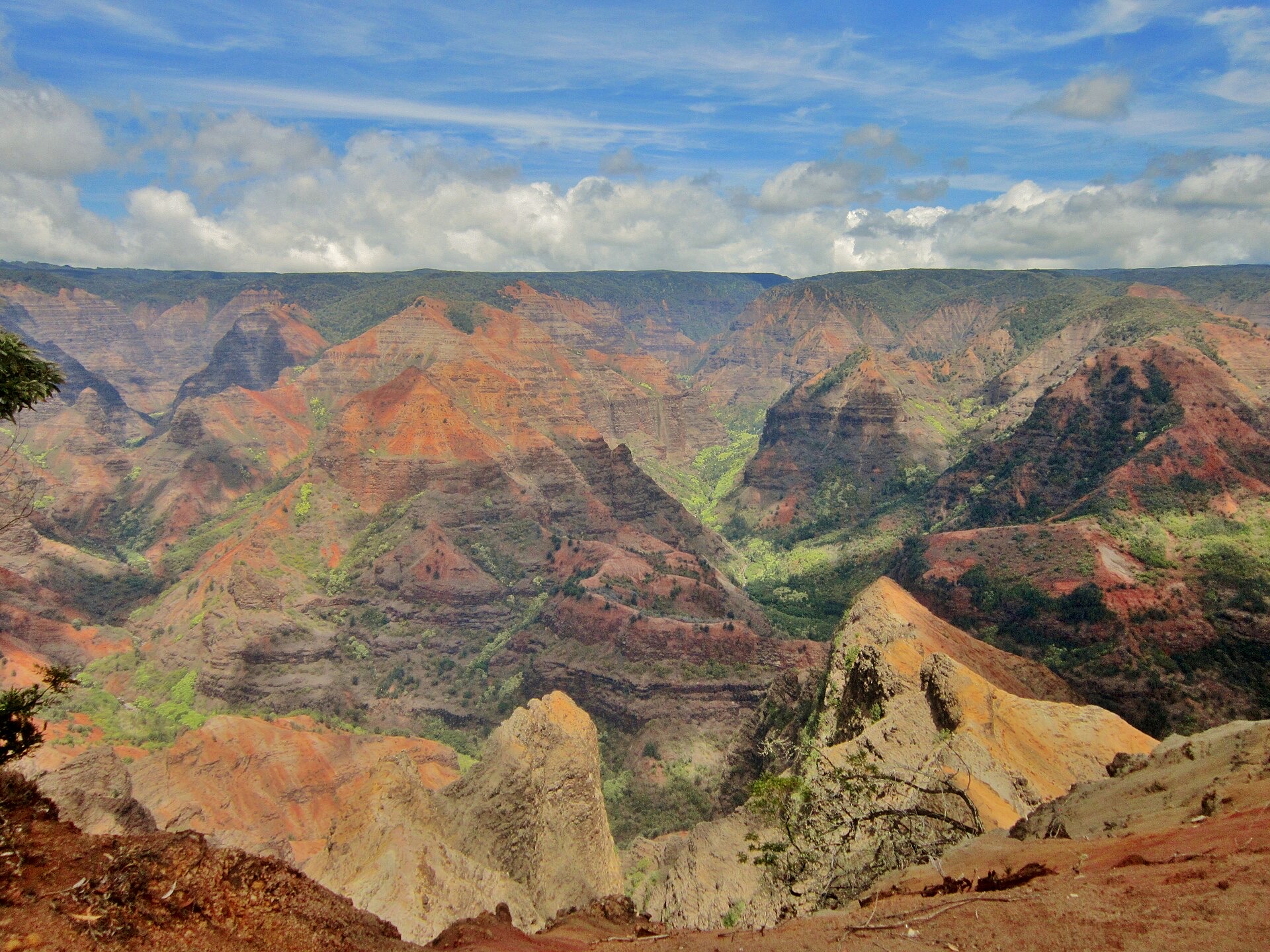
Waimea Canyon, on the dry west side of the island. Photo : Michelle Maria, Wikimedia Commons, CC BY 3.0.

- North shore beaches and snorkelling: May to September only. Kee, Tunnels and Anini are calm then and dangerous in winter.
- Napali coast by boat: May to September, when the north swell is gone. Winter trips run from the west side and turn back more often.
- Waimea Canyon and Kokee: any month, but the lookouts clear more often in summer. Kokee is 12 °F cooler than the coast, averaging 73 °F (22.8 °C) in August at 3,600 feet.
- Whale watching: January to March, from Kilauea Point or by boat out of Port Allen.
- Helicopter tours: summer for the highest chance of flying, although the waterfalls are fuller in March. See our helicopter tour guide.
- Families: Poipu in any season; our guide to snorkelling Poipu with young children covers the sheltered reef.
- Value and quiet: September, the lowest arrival month of 2025, and covered in our article on September as the island's shoulder window.
Events that shape the year
- Waimea Town Celebration, February: the west side's biggest week, with a rodeo, a fun run and Hawaiian music at the old mill site in Waimea.
- Prince Kuhio Day, March 26: a state holiday marking the birth of Prince Jonah Kuhio Kalanianaole, born on Kauai, with events around Poipu.
- Koloa Plantation Days, July: ten days of parade, rodeo and history in Old Koloa Town, running July 17 to 26 in 2026.
- Kauai Marathon, September: a road race through the south shore hills. The 2026 edition, set for September 6, was cancelled as Hurricane Lowell approached the island.
- Christmas and New Year: together with July, the hardest fortnight of the year to book.
Where to stay
On Kauai the shore you choose matters more than the month. The south shore is drier and calmer in winter; the north shore is greener and better in summer.

Hanalei Bay and its pier. Illustration: Stay In Kauai. Illustration : Luxury and Premium Hotel Booking in Kauai.
- Koloa Landing Resort at Poipu: on the dry south shore, the safest bet for a winter stay.
- The Lodge at Kukuiula: above Poipu, close to the south shore beaches and the Kukuiula market.
- Timbers Kauai at Hokuala: on Kalapaki Bay near Lihue, the most central base and the shortest airport transfer.
- Sheraton Kauai Resort Villas: Poipu again, a family option on the sunny side.
- Princeville rentals: the north shore base, at its best from May to September.
- South shore or north shore for couples: the two sides compared for a romantic stay.

The Na Pali coast from the water. Illustration: Stay In Kauai. Illustration : Luxury and Premium Hotel Booking in Kauai.
FAQ
What is the best month to visit Kauai?
May. Rain at Lihue has dropped to 2.2 in (55 mm), the sea is at 78 °F (25.7 °C), the north shore is calm enough to swim and the July crowds have not arrived. June and September are close behind. March is the month to avoid on weather alone, at 5.6 in (142 mm) at Lihue and 8.3 in (210 mm) on the north shore.
What is the rainy season in Kauai?
November to March, though Kauai rains a little in every month. Lihue records between 4.4 and 6.9 rain days in each month of the year; what changes is the volume, from 1.8 in (44 mm) in July to 5.6 in (142 mm) in March. Showers are usually brief and local rather than all day.
Which side of Kauai has the best weather?
The south and west. Barking Sands on the west coast averages 17.8 in (452 mm) of rain a year over 31 days, and Poipu on the south shore sits in the same rain shadow. Princeville on the north shore averages 75.2 in (1,910 mm) over 152 days. That is why the big resorts are in the south.
What is the cheapest time to visit Kauai?
September, and to a lesser degree late April and May. September 2025 brought 102,105 visitors to Kauai against 143,289 in July, according to Hawaii's Department of Business, Economic Development and Tourism, and rates follow the arrivals. The trade off is that September sits inside hurricane season.
When is whale season on Kauai?
Humpbacks are in Hawaiian waters from November to May, with the peak from January to March, according to the NOAA sanctuary that protects them. On Kauai you can watch from land at Kilauea Point, Makahuena Point and the Kapaa bluff. Boats run mainly from Port Allen on the calmer west side in winter.
Can you swim on the north shore in winter?
Usually not. North Pacific swell reaches north facing shores from October to April, and beaches that are calm all summer, including Kee, Tunnels and Hanalei, become dangerous. In winter, swim on the south shore at Poipu or Salt Pond, and only at a beach with a lifeguard.
Is 7 days in Kauai too much?
No. Seven days is about right: the island is 552 square miles with one main road, and a Napali boat trip, a Waimea Canyon day, a north shore day and a Poipu beach day already fill four. A week also absorbs one rained out day, which on Kauai is likely in any month.
Do you need a reservation for Haena State Park?
Yes. Entry to Haena State Park at the end of the north shore road, including the Kalalau Trail trailhead, requires an advance reservation for entry, parking or the shuttle, released 30 days ahead by the Hawaii Division of State Parks. Hikers going past Hanakapiai need a separate Napali Coast permit.